OpenCities Map Help

Associate Linkages

Associate Linkages is used to copy database linkages to centroids, boundaries, and area elements.

Several OpenCities Geospatial Administrator operations assume that the centroid element is linked to a database row and that the database row applies to the entire area. Thematic mapping and topological analysis operations require these database links.

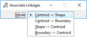
Database linkages may be copied to and from centroids, shapes, and boundaries.

Setting Description
Mode
  • Centroid > Shape - Copies database linkages from a centroid to the shape that contains the centroid.
  • Centroid > Boundary - Copies database linkages from a centroid to the boundary linework that infers an area. The centroid must be contained within this area.
  • Shape > Centroid - Copies database linkage from a shape element to its centroid. The centroid must be contained within the shape.
  • Boundary > Centroid - Copies database linkages from a boundary to its centroid, when each boundary has a linkage for each area that it faces. For each area that is inferred from the boundaries, all centroids are found and the database linkages that are common to all surrounding sides are copied to the centroid element as read-only data.

To associate linkages:

  1. Place a fence around the target elements.
  2. Select the Associate Linkages tool.
  3. Set the Mode.
  4. Initiate the processing with a data point.
  5. Review the content of the Results dialog.

The results may be saved or appended to a text file by selecting the appropriate option from the Results dialog File menu.

Key-in: ASSOCIATE LINKAGES